Dam Failure

A dam is defined by KRS 151.100 as any artificial barrier that compounds or diverts water and is either 25-feet in height from the downstream toe to the crest of the structure or has a maximum water storage elevation capacity of 50-acre feet or more. Dams serve a multitude of purposes, including human water supply, irrigation, energy generation, recreation, and flood control.

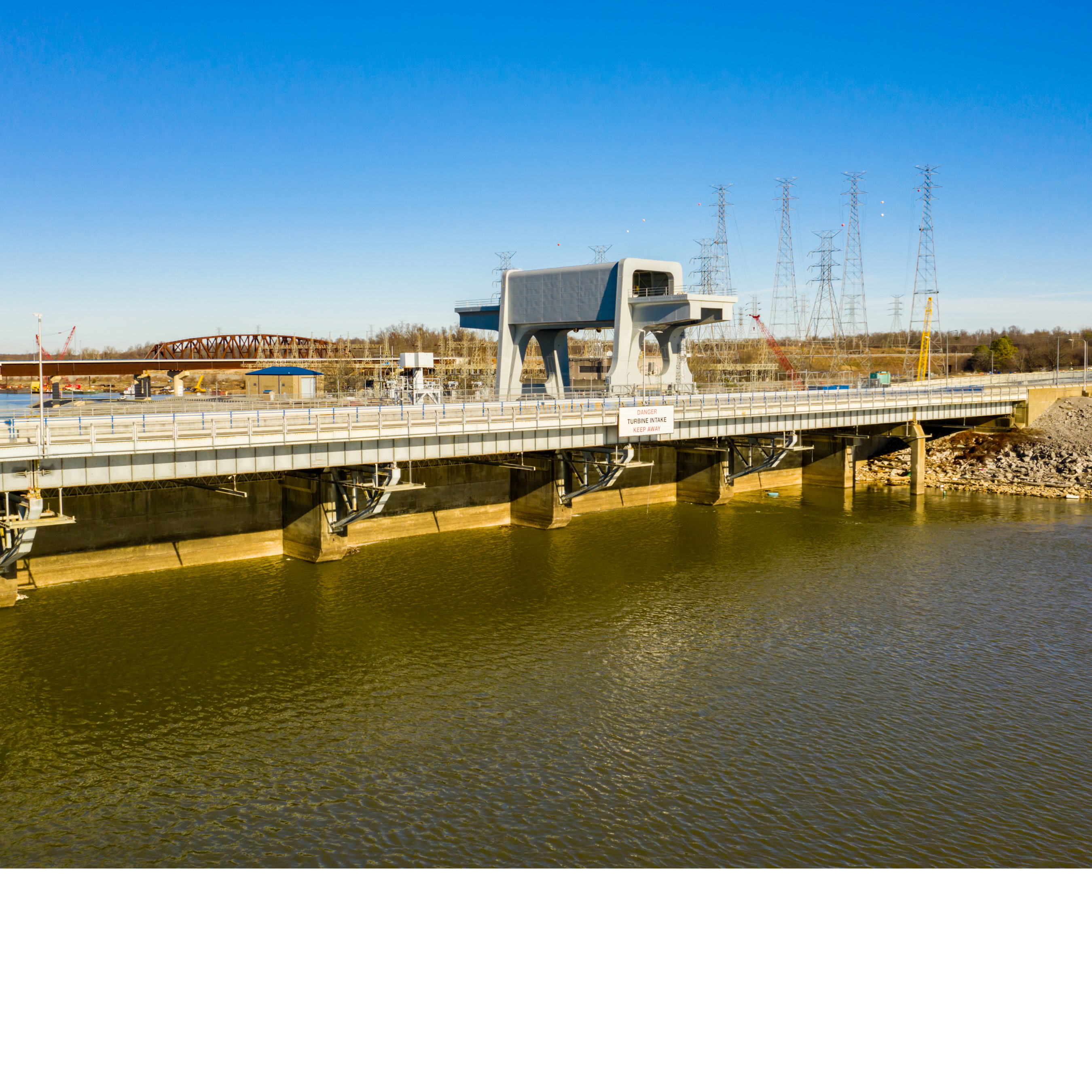
Description of Dam Failure

There are two primary types of dams: embankment and concrete. Embankment dams are the most common and are constructed using either natural soil or rock or waste material from a mining or milling operation. They are often referred to as “earth-fill” or “rock-fill” based upon which of those two types of materials is used to compact the dam. Concrete dams are generally categorized as either gravity or buttress dams. Gravity dams rely on the mass of the concrete and friction to resist the water pressure. A buttress dam is a type of gravity dam where the large mass of concrete is reduced and the force of water pressure is “diverted to the dam foundation through vertical or sloping buttresses.”

The Energy and Environment Cabinet, authorized by KRS 151.293 Section 6 to inspect existing structures that meet the above definition of a dam, further notes three classifications of dams:

  • High Hazard (C) – Structures located such that failure may cause loss of life or serious damage to houses, industrial or commercial buildings, important public utilities, main highways or major railroads.
  • Moderate Hazard (B) – Structures located such that failure may cause significant damage to property and project operation, but loss of human life is not envisioned.
  • Low Hazard (A) – Structures located such that failure would cause loss of the structure itself but little or no additional damage to other property.

High- and moderate-hazard dams are inspected every two years. Low-hazard dams are inspected every five years.

Within the BRADD region, there is one High Hazard (C) Dam: Mill Creek MPS 4 in Monroe County.

Extent of Dam Infrastructure

The American Society of Civil Engineers gave Kentucky a D+ on dam infrastructure, which is only slightly better than the national average. The average US dam is 60 years old, and most dams in Kentucky are over 50. As of 2019, 80 dams in the state are classified as two-fold risks, meaning that they are both high hazards and in poor or unsatisfactory condition. 47% of these 80 dams received that rating partially because they cannot hold enough rain during catastrophic storms. 89% of high hazard dams in Kentucky do not have complete emergency action plans on file with the state. 74% have simplified draft plans, but these are not widely shared and have not been adopted by local officials.

Types of Dam Failure

There are three types of Dam Failure:

  1. Structural: This common cause is responsible for nearly 30% of all dam failure in the United States. Structural failure of a dam occurs when there is a rupture in the dam or its foundation.
  2. Mechanical: Refers to the failure or malfunctioning of gates, conduits, or valves.
  3. Hydraulic: Occurs when the uncontrolled flow of water over the top, around, and adjacent to the dam erodes its foundation. Hydraulic failure is the cause of approximately 34% of all dam failures.

History of Dam Failure

The National Performance of Dams Program (NPDP), which maintains a database of failures for all dams listed in the National Inventory of Dams, lists ten dam failures in Kentucky since 1850, none of which occurred in the Barren River Region. The Barren River Region has been fortunate not to experience a dam failure; however, the potential is still there. The Corps of Engineers and Stantec (contractor) are conducting a study on the Rochester Dam’s potential failure. The final report with proposed alternatives and cost estimates were set to be released winter 2011.

Also of concern is Wolf Creek Dam. While it is not located within the BRADD region, failure of the dam would impact eastern Monroe County. In late 2007, the Army Corps of Engineers placed the dam under a ‘high risk’ for failure designation. A new long-term solution was proposed to solve, or control, the current seepage problem which began to be implemented in 2007 and is still underway.


Probability

The probability of a dam failure in the BRADD region is low but non-zero, with likelihood influenced by dam design and age, inspection/maintenance practices, spillway capacity, operational conditions, and compounding stressors such as extreme rainfall or prolonged saturation. While most dams operate safely under routine monitoring and Emergency Action Plans, the chance of structural or operational failure rises during severe storms and when downstream development expands into potential inundation zones. Given the high-consequence nature of even rare failures, consequence-focused planning, inspections, and public alerting remain essential.

Impact

Dam failures cause flooding much different from natural flooding. A flood from a dam failure may arrive before any warning or evacuation can take place and the resulting wall-of-water makes evacuation based on limited environmental cues very problematic. The failure of large dams results in flooding with enough energy to damage or destroy residences and other structures. Dam failure can occur at any time, but is often the result of other hazards, such as flooding or earthquake.

Built Environment

Actual dam failure not only results in the loss of life, but also results in considerable loss of capital investment and income, as well as property damage. In the event of a catastrophic dam failure, community systems will be severely strained. Debris carried downstream can block roads, disrupt traffic patterns, and delay the delivery of essential services along traffic corridors. The region will experience a disruption of lifeline facilities and emergency services. The loss of a reservoir (drinking water source) can also cause considerable hardship for the community that relies upon it for its water supply.

Natural Environment

Dam failure can displace aquatic species, cause erosion, and disrupt habitats. Other environmental effects as the result of flooding from dam failure include the likely dispersal of debris and hazardous materials downstream that could damage local ecosystems.

Social Environment

Social vulnerability concentrates where people live or work in low-lying areas, where warning/evacuation routes are limited, or where populations have fewer resources to recover; lack of widely adopted Emergency Action Plans (EAPs) further elevates consequence potential. These vulnerabilities are amplified by aging dams statewide and the region’s karst context, underscoring the need for up-to-date inspections, EAP adoption, and coordinated downstream planning.

Changing Climate & Dam Failure

Dam failure occurs as an indirect effect of climate change, driven by other hydrologic variables. Climate change leads to an increase in rainfall that contributes to a rise in water level. The water level can eventually rise above the dam, known as overtopping, and cause it to fail. Climate change is not often factored into the building of dams, which can cause damage in the future as storm severity and intensity increases, or from a change in rainfall patterns, which are predicted to occur in coming decades.

Potential impacts include:

  • Economic loss
  • Infrastructure damage
  • Flash flooding
  • Disrupt ecosystems and biota
  • Threats to life and property

Vulnerability

Vulnerability to dam failure in the BRADD region encompasses the built, natural, and social environments, reflecting the widespread consequences that could follow a sudden or uncontrolled release of water. Downstream communities, transportation routes, and public infrastructure located within inundation zones are most at risk of structural damage or complete loss. The natural environment, including river corridors, wetlands, and agricultural lands, may experience severe erosion, sedimentation, and contamination from debris or hazardous materials mobilized by floodwaters. Socially, populations living or working in low-lying areas near dams—particularly those with limited access to timely warnings or evacuation routes—are especially vulnerable to injury, displacement, and economic disruption. Evaluating these vulnerabilities helps local jurisdictions strengthen emergency action plans, maintain dam inspection programs, and prioritize mitigation measures that protect lives, property, and environmental resources.

Summary Analysis

The following county summaries translate dam‐failure risk into local context by considering downstream development, mapped or likely inundation areas, lifeline infrastructure (roads, bridges, water/wastewater, power), environmental sensitivities (karst, river corridors, wetlands), and social factors such as warning access and evacuation routes. Differences in dam location, hazard classification, age/condition, and proximity to populated areas drive variation in potential consequences across the BRADD region.

Allen County

Vulnerability is driven by development in downstream lowlands and along waterways. While most potential consequences would be localized, any failure upstream of populated areas could damage structures, roads, and utilities; karst conditions raise concern for rapid groundwater impacts from debris and contaminants. Preparedness hinges on identifying inundation paths and ensuring downstream alerting and evacuation routes.

Barren County

Downstream communities and transportation corridors face exposure where flow paths intersect developed areas and lifelines. Karst/sinkhole features heighten environmental vulnerability by accelerating subsurface transport. Mapping of potential inundation, continuity planning for utilities, and coordination with adjacent jurisdictions are key to reducing risk.

Butler County

Communities and infrastructure situated along river corridors are sensitive to breach waves and debris loads. Historic attention to the Rochester Dam (study of potential failure consequences) highlights the importance of consequence assessment and cross-jurisdictional coordination for downstream warning and evacuation.

Edmonson County

Low-lying development and roads near streams are susceptible to fast-moving flood waves from an upstream release. Karst terrain and cave systems increase environmental stakes by facilitating rapid infiltration and ecosystem disturbance, emphasizing the need for spill/debris management planning after a breach.

Hart County

Vulnerability centers on downstream settlements and critical routes that could be cut off. Even moderate failures can deposit debris that blocks access and delays emergency services. Adoption and exercising of EAP elements with local responders can mitigate life-safety risks despite the low frequency of events.

Logan County

Exposure is greatest where downstream flow paths intersect residential areas, small businesses, and essential services. Given aging dam infrastructure statewide and variable EAP adoption, consequence-focused planning (alerting, route redundancy, and sheltering) remains the priority.

Metcalfe County

Built assets are generally dispersed, limiting large-scale structural exposure; however, rural roads, culverts, and utilities in narrow valleys are vulnerable to washouts and service loss. Karst increases the risk of groundwater contamination from mobilized debris and hazardous materials during a breach.

Monroe County

Risk is elevated relative to the region: Mill Creek MPS 4 is classified as a High Hazard (C) dam, and Wolf Creek Dam, while outside BRADD, could impact eastern Monroe County if it failed. Downstream communities, roads, and utilities require robust alerting/evacuation coordination and consequence-based drills.

Simpson County

Downstream neighborhoods and commercial corridors could experience rapid inundation and debris impacts, with secondary consequences to water and wastewater facilities. Ensuring EAP awareness among local officials and the public can reduce life-safety impacts where warning times are short.

Warren County

With the region’s largest population and critical infrastructure, Warren County faces the highest potential consequences should a significant upstream failure send a flood wave into developed areas. Bridge closures, utility outages, and facility disruptions can cascade quickly. Strong emergency management capacity is an advantage, but large events could still strain resources.