Earthquake
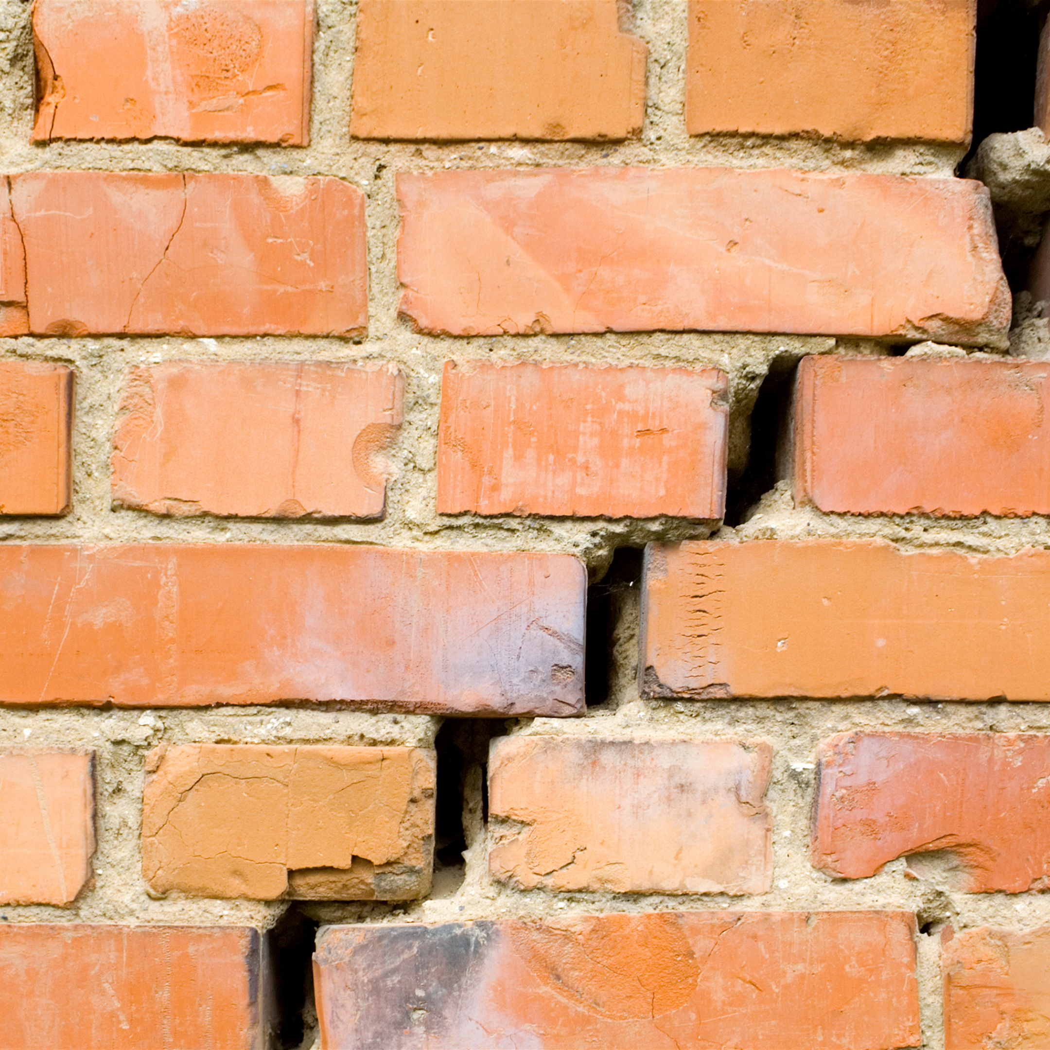
An earthquake is a geologic event that involves sudden, rapid shaking of the Earth caused by the breaking and shifting of rock beneath the Earth’s surface. Earthquakes can affect hundreds of thousands
of square kilometers, causing damage to property, resulting in loss of life and injury, and disrupting the social and economic functioning of the affected area.
Ground motion, the movement of the earth’s surface during earthquakes or explosions, is the mechanism for most of the damage during an earthquake. Produced by waves generated by a sudden slip on a fault or
sudden pressure at the unstable source, ground motion travels through the earth and along its surface. Ground motions are increased by soft soils overlying hard bedrock, referred to as ground motion amplification. Ground
motion amplification can cause an excess amount of damage during an earthquake, even to sites very far from the epicenter. The level of damage depends on the amplitude and duration of the shaking, which are directly related
to the earthquake size, the distance from the fault, the site and the regional geology.
Ground shaking from earthquakes can collapse buildings and bridges, disrupt gas, electric, and phone service, and sometimes trigger landslides, avalanches, flash floods, fires, and huge, destructive
ocean waves (tsunamis). Buildings with foundations resting on unconsolidated landfill and other unstable soil, and trailers and homes not tied to their foundations are at risk because they can be shaken off their mountings
during an earthquake. When an earthquake occurs in a populated area, it may cause deaths and injuries and extensive property damage.
Liquefaction occurs when strong earthquake shaking causes an immediate weakening of soils such that the soils take on properties similar to quicksand. Liquefaction most often occurs in artificial fill,
and in highly saturated loose and sandy soils, such as low-lying coastal areas, lakeshores, and river valleys. Susceptibility to liquefaction is measured by the physical characteristics of a soil, such as grain, texture,
compaction, and depth of groundwater. Soil liquefaction and intense ground shaking often cause the
most damage during an earthquake.
Description & Background
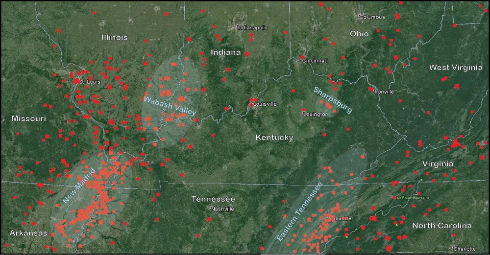
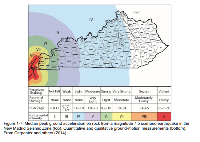
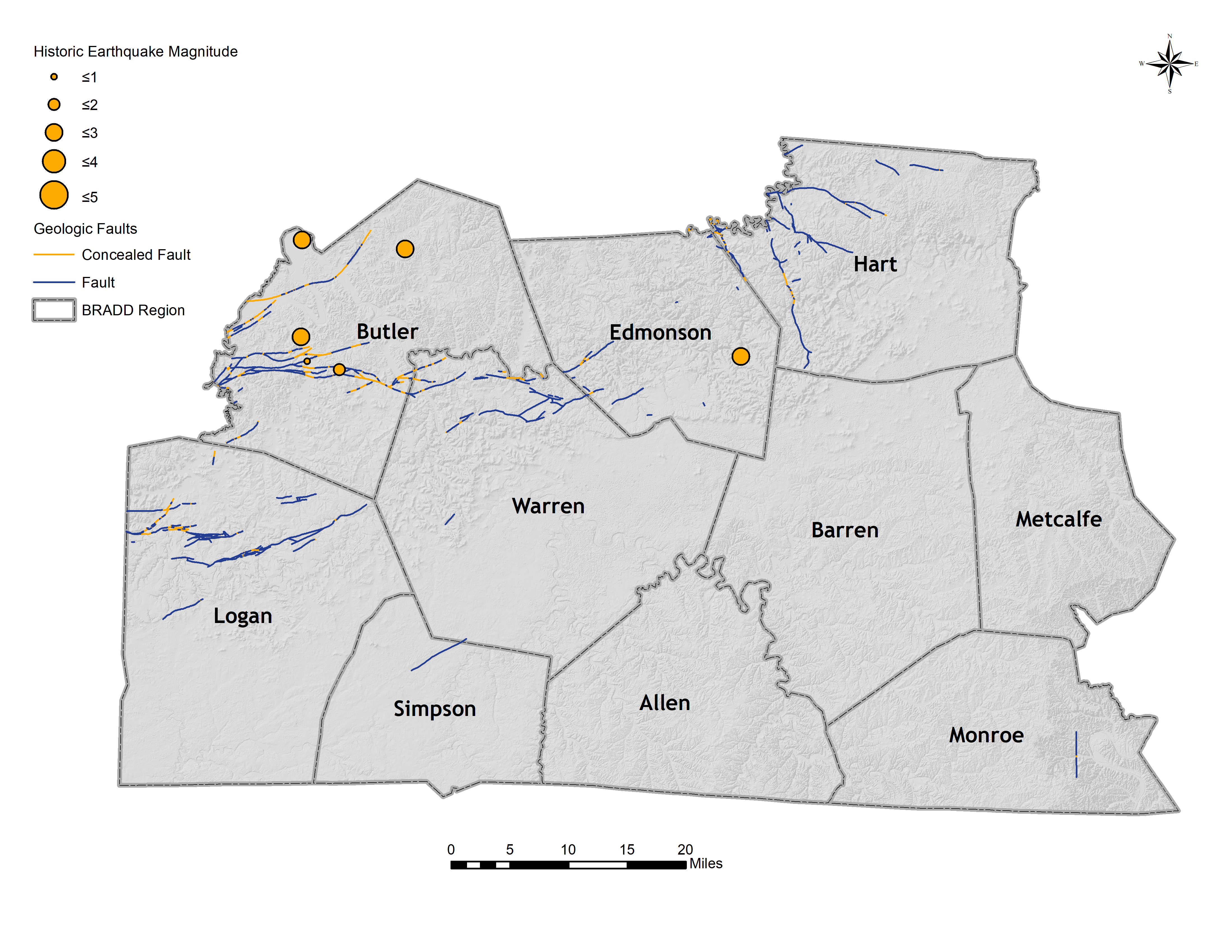
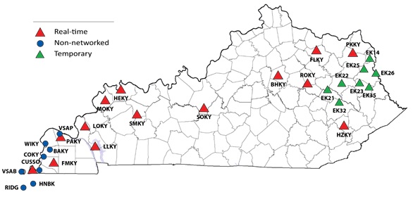
According to the Kentucky Geological Survey, the strongest historic earthquake recorded inside Kentucky’s borders was the magnitude 5.2 Sharpsburg earthquake of July 27, 1980, in Bath County. The quake caused an estimated $3 million in damage in Maysville. The 2012 Perry County earthquake (magnitude 4.2) caused minor damage to the Letcher County Courthouse in southeastern Kentucky. The most significant earthquakes to have affected Kentucky occurred from December 1811 to February 1812 in the New Madrid Seismic Zone. At least three large earthquakes, each estimated to have been greater than magnitude 7, occurred during that period. Though the state was sparsely settled then, these earthquakes affected the whole commonwealth. The New Madrid Seismic Zone is the most active seismic zone in the central and eastern United States, and a repeat of earthquakes with the same magnitude as the 1811-12 earthquakes could cause significant damage in Kentucky.
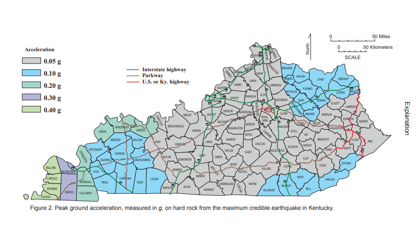
Although predicting earthquakes is impossible, the potential damage they cause can be mitigated through earthquake-resistant measures, such as codes for buildings, homes, and infrastructure. The Kentucky Building and Residential Codes were developed from a complicated process that started with a group of engineers, seismologists, and others using the national seismic hazard maps developed by the U.S. Geological Survey and engineering science. The codes developed a set of recommendations, including design ground motions, for seismic regulations for new buildings and other structures. These recommendations were endorsed by the Federal Emergency Management Agency and thus became federal policy, along with associated regulations for seismic safety. The recommendations were then adopted by state government agencies, as well as nongovernmental organizations such as the International Building Code Council.
Types of Fault Lines
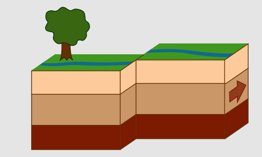
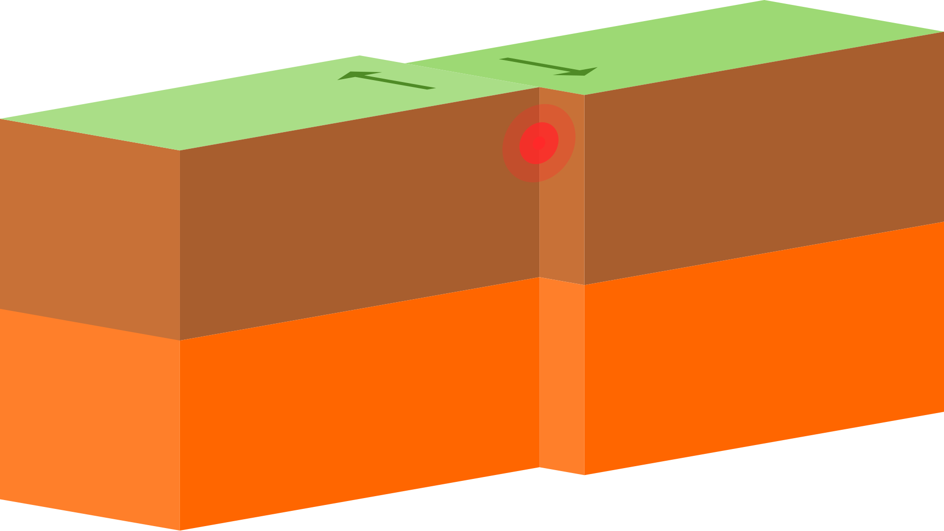
Strike-slip faults have walls that move sideways, not up or down. That is, the slip occurs along the strike, not up or down the dip. In these faults the fault plane is usually vertical, so there is no hanging wall or footwall. The forces creating these faults are lateral or horizontal, carrying the sides past each other. Strike-slip faults are either right-lateral or left-lateral. That means someone standing near the fault trace and looking across it would see the far side move to the right or to the left, respectively. The one in the picture is left-lateral.
Types of Boundaries
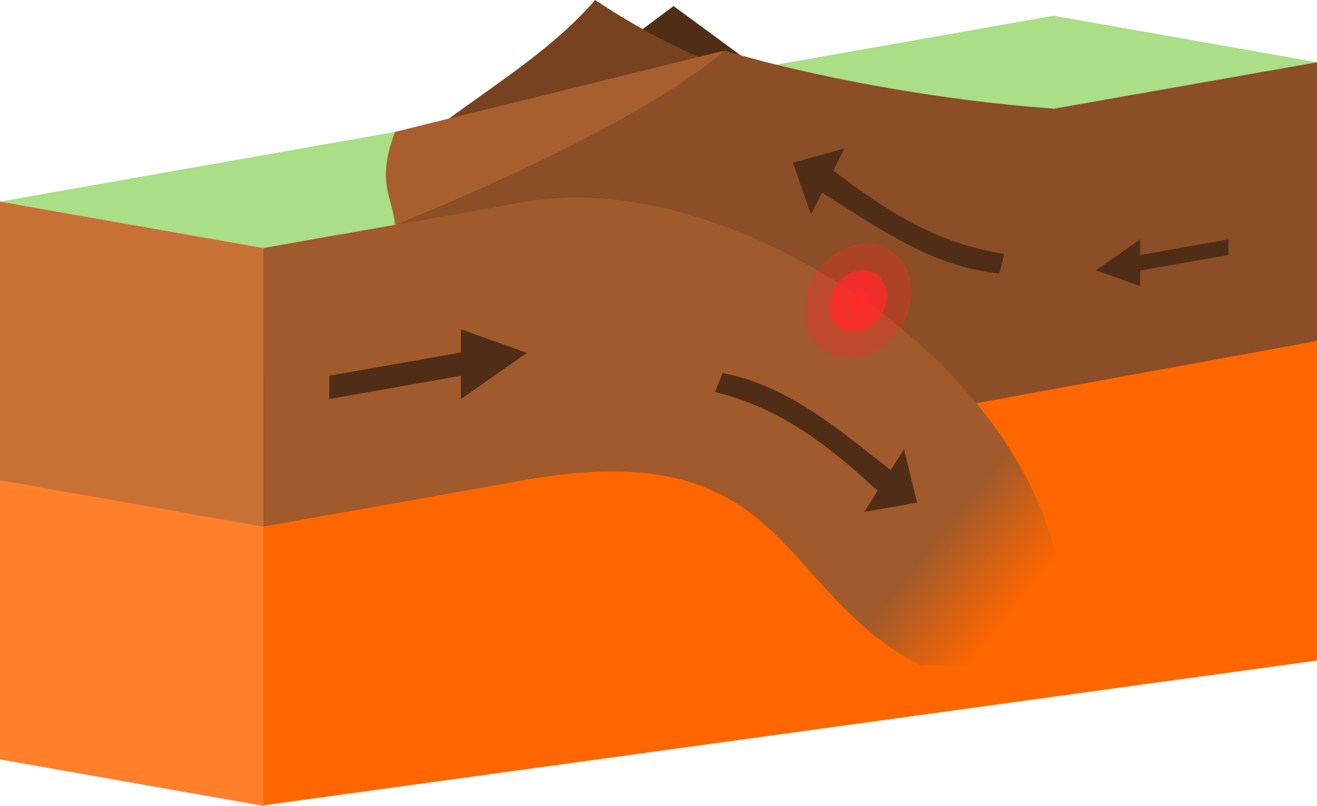
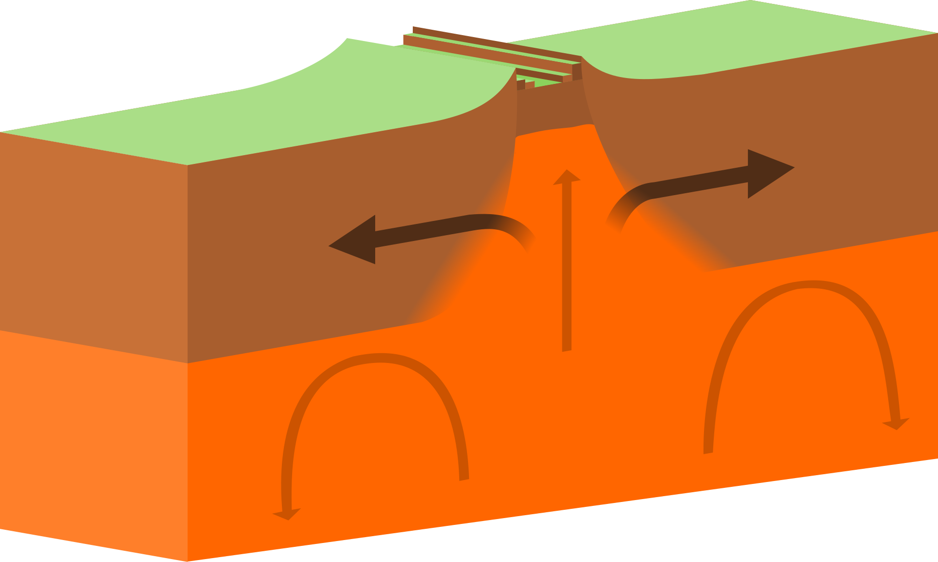
Divergent/Constructive Plate Boundary – occurs when the two plates’ boundaries are moving away from one another forming new crust.
